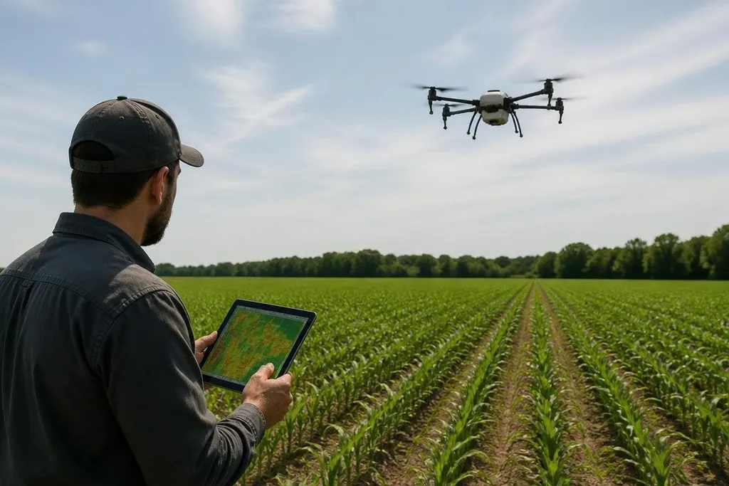
A farming drone can inspect a field from above in minutes, then give a grower a map to check on the ground. That matters when crops cover too much land for a person to inspect row by row. The value comes from the information it collects, not from the aircraft itself.
- Aerial images can show gaps, weeds, standing water, or crop stress.
- Spraying drones can treat small areas without sending a tractor across the whole field.
- Better maps help growers decide where to look, sample, or act next.
One flight can show more than a walk
A person walking a field sees what is close to the path. A drone can record a wider area from the same height and route, giving the grower a map instead of a handful of observations.
The camera matters. A standard RGB camera records visible color. Multispectral cameras read bands of light that people cannot see, while thermal cameras measure heat. These tools can point to differences in plant health, soil moisture, or crop growth that deserve a closer check.
The map still needs a person who understands the field. A pale patch may come from a blocked irrigation line, poor soil, disease, or a camera error. The drone narrows the search; it doesn't make the diagnosis alone.
Drones can cut unnecessary field passes
A tractor pass can press soil, use fuel, and take time. If a drone map shows that a problem affects one section, the grower can inspect or treat that section instead of covering the whole field.
That approach works best when the next action is clear. A map that only says “something changed here” has limited use unless the grower can connect it to a field check, a sample, or a treatment plan.
Spraying drones add another use. Their small tanks and low flight paths suit spot treatment in places where a tractor cannot move easily, such as wet ground or steep rows.
Their size also limits them. A small tank means more refills, and wind can affect where liquid lands.
The data must fit farm work
The aircraft produces images, but images alone don't improve a harvest. The useful step is turning those images into a task: inspect this row, test this soil, check this valve, or treat this patch.
The useful test comes after the map flags a problem. A Robot 24 report can connect that image to the inspection or treatment step that followed, giving a grower a way to judge the drone by field work, not image quality alone. That comparison only works when each flight follows the same route.
A grower also needs a repeatable flight plan. Flying the same area at different heights, speeds, or times of day can make comparisons harder. A fixed route, clear weather notes, and regular image checks give the map more value than a single flight made at random.
Where farming drones still fall short
Drones need a safe launch area, trained operators, charged batteries, and a plan for weather. Rules for flight and chemical spraying can also vary by location, so a farm needs to check local requirements before work begins.
The images may need storage, processing, and software that cost extra. Weak mobile coverage can slow uploads, while poor lighting or wind can reduce the quality of a flight. A drone that spends more time being repaired than collecting useful data has missed the point.
The business case also depends on the farm. A small operation with simple fields may get enough information from a scouting walk and a phone. Larger farms, scattered parcels, and crops that need close checks give aerial tools more room to earn their cost.
A practical buying check
Before choosing a farming drone, write down the job it must do. Then check these points:
- Define the task: Choose mapping, crop checks, spraying, or another clear job.
- Check the camera: Match RGB, multispectral, or thermal sensing to the problem.
- Count the field time: Include battery swaps, refills, flight setup, and image processing.
- Plan the next action: Decide who will inspect a flagged area and what they will measure.
- Price the full system: Add software, batteries, repairs, training, and legal checks.
- Set a trial rule: Pick a field section and a result that would justify wider use.
I’d buy a farming drone for a defined inspection or spot-treatment task, then measure the saved field trips before adding more hardware. The aircraft is only one part of the system; the useful result is a better decision made with less wasted work.
The next step is clear: run one repeatable field trial, record the time and treatment area, and keep the drone only if those numbers improve.